S is for Scotland (click here for map.) A 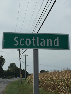 very scenic 2 hour drive landed me in the town located on the southernmost end of the State. I was anxious to travel to an area of Maryland I had never been before, and to visit a town filled with a plethora of history dating back to the American Civil War.
 very scenic 2 hour drive landed me in the town located on the southernmost end of the State. I was anxious to travel to an area of Maryland I had never been before, and to visit a town filled with a plethora of history dating back to the American Civil War.
Scotland is an unincorporated town located on the western shore of the Chesapeake Bay in St. Mary’s county. The town has 368 residents, a land area of 5.95 square miles, and a water area of 8 square miles.
I was unable to determine when the town was actually founded – only when Point Lookout (now a State park) was discovered.
According to the Park’s history, Captain John Smith explored the Point in 1612. In 1632, it was included in King Charles I's grant to George Calvert, Lord Baltimore. Calvert's younger son, Leonard, (Maryland's first governor) claimed the Point for his personal manor in 1634.
I was unable to determine when the town was actually founded – only when Point Lookout (now a State park) was discovered.
 |
| Point Lookout State Park - Chesapeake Bay side |
You are probably wondering how Scotland got its name. I could not find anything definitive in print, but I think I got close. According to Scotland’s Mark on America:
In Maryland there seems to have been a colony of Scots [in] 1670 under Colonel Ninian Beall, settled between the Potomac and the Patuxent, and gradually increased by successive additions. Through his influence a church was established at Patuxent in 1704, the members of which included several prominent Fifeshire families. Many other small Scottish colonies were settled on the eastern shore of Maryland and Virginia, particularly in Accomac, Dorchester, Somerset, Wicomico, and Worcester counties. To minister to them the Rev. Francis Makemie and the Rev. William Traill were sent out by the Presbytery of Laggan in Ulster. Upper Marlborough, Maryland, was founded by a company of Scottish immigrants and [was] ministered to by the Rev. Nathaniel Taylor, also from Scotland. Two shiploads of Scottish Jacobites taken at Preston in 1716 were sent over in the ships Friendship and Good Speed to Maryland to be sold as servants.
Just reading how Scotland may have gotten its name raised my interest in this town to a new level.
 |
| Former Post Office |
My historic journey began a few miles after I crossed into town. Scotland’s former Post Office (now a residence) was the first thing I saw. Shortly thereafter, I passed Buzzy’s Country Store where I planned on returning for lunch. I decided not to stop as Point Lookout State Park was the first thing on my agenda.
Point Lookout State Park occupies 1,046 acres on a narrow peninsula at the southern tip of St. Mary’s County. The Chesapeake Bay is on one side of this peninsula; the Potomac River is on the other, and these great bodies of water converge at the very tip of the Park. While there are many recreational aspects of this Park, I want to spend more time discussing the historical significance of this area. This Park is probably best known as the location of a Union hospital and infamous Union prison camp, which housed Confederate prisoners during the American Civil War.
 |
| Point Lookout One-Time Seaside Resort (marker photo) |
 it was decided the Point Lookout area was large enough to also accommodate a camp for Confederate prisoners. The camp was located a short distance away.
After the Battle of Gettysburg, construction began on a 30-acre camp capable of holding 10,000 prisoners of war. Officially, the place was known as Camp Hoffman. No barracks were ever built and the prisoners had to sleep in tents – the camp was only 5 feet above sea level! In September 1863, the prisoners totaled 4,000. Three months later, over 9,000 Confederates were imprisoned. As the war progressed, the camp became over-crowded with more than 20,000 prisoners. Filth prevailed, wells became contaminated, and prisoners literally froze to death in tents. The low, marshy land of the area bred disease among the prisoners and they soon started to die from smallpox, dysentery, and scurvy – 3,384 prisoners perished. By the time the American Civil War ended, over 52,000 prisoners had passed through its gates! It was the largest prison camp of the war.
Have you noticed I keep saying prisoners…and not soldiers? The camp’s prisoners not only included soldiers, but civilian men, women, and children. It is also interesting to note the youngest prisoner at Point Lookout was Baby Perkins. He was born there. His mother, Jane Perkins, was captured at the Battle of Spotsylvania with her artillery unit. If you access the attached link (http://www.plpow.com/Poems&Songs.htm), you will find a list of poems and songs written about Point Lookout. The first song listed is about Baby Perkins, “Cry, Little Artillery Man.”

The “Prison Pen” was the area where the prisoners were held. A small section of this area has been reconstructed where the original structure once stood. It was a short walk from the parking lot to get there. I wandered around for a bit and then stopped, took a step back, and looked out over the “Prison Pen” – I found the entire experience to be extremely sobering. I honestly did not expect this situation to be so disturbing for me. It was really difficult to fathom this war could have even happened – “Brother against Brother.” And what was going on at this prison camp? Americans were capturing fellow Americans and exposing them to deplorable conditions on American soil.
 |
| Prison Pen |
 |
| Outside Fort Lincoln |
Because the Confederate Army tried several times to take the camp and free the prisoners, the Union troops built three fortifications near the “Prison Pen” to stop any future plans of freeing the prisoners. Fort Lincoln is the only one remaining (I was unable to find the names of the other two.)
In 1978, the organization “Friends of Point Lookout” was formed. This group promotes the preservation of and public education about historical sites at Point Lookout State Park.
 |
| Fort Lincoln (L to R) - Officer's quarters, Enlisted barracks, guard house |
Over the years, they performed an excellent restoration of four of the Fort’s buildings - two officer’s quarters, an enlisted barracks, and a guard house.
On the way to the hospital’s location, I came across the Contraband Camp marker t
 hat was on my “To See” list. To better explain what this camp was, this is what was on the marker’s inscription:During the Civil War, thousands of enslaved African-Americans escaped from captivity in the South to liberty in the North. The grounds before you once sheltered these freedom-seekers, known at that time as “Contraband”. Conditions in the “Contraband Camp” were appalling. Men, women and children lived half underground in dark, damp, smoky dens. Nurse Sophronia Bucklin’s first-hand accounts of the “Contraband Camp” described men burrowing like “beasts of the field in half-subterranean dens.” Nurse Sophronia Bucklin described the scene: “A hole from three to four feet deep was dug by them in the black soil, and roofed over with boards, on which turf was closely packed. An opening which admitted them on their hands and feet, and one for the escape of smoke…were the only vents for the impure air, and the only openings for light.”
Unfortunately, contrabands were not considered citizens. Despite the monumental step towards freedom it represented for the many who sought contraband status, it wasn’t until late 1865 when the Thirteenth Amendment was adopted allowing contrabands to become eligible for full emancipation.
As mentioned earlier, Hammond General Hospital (a war hospital)
was constructed on the Point Lookout peninsula. It consisted of 20 buildings arranged like the spokes of a wheel. Fifteen of the buildings were used as wards and the hospital could handle 1,400 patients. The hospital was torn down in 1865 when the American Civil War ended. However, there is a marker denoting the general location of the hospital.
When I reached the area where the hospital once was,
I could not even imagine a complex of that magnitude existing there. I noticed the peninsula was showing a lot more land in the archived records than can be seen today. I suspected erosion, but how much? It is written in Maryland records that from 1849 to 1938
the Chesapeake Bay shoreline receded as much as 950 feet! Fortunately, a riprap revetment was installed in 1973 halting the erosion. The Potomac River shoreline has basically retained its same shape with only 50 feet of variation.
As mentioned earlier, Hammond General Hospital (a war hospital)
 |
| Hammond General Hospital (lower left) (marker photo) |
When I reached the area where the hospital once was,
 |
| Hospital Marker |
 |
| Hospital Marker |
A few hundred yards away from where the hospital once stood was the Point Lookout Lighthouse. As I turned to walk over to the lighthouse, something caught my eye. A monarch butterfly!
And not just one…..they were everywhere! I used to see them all the time when I was younger, and then the sightings began to decline. Most recently, I heard they were in danger of becoming “quasi-extinct.” This means that the monarch butterfly would see its numbers dwindle so low that it may not be able to rebound. Researchers say there is an 11 to 57 percent chance this could happen to the species over the next 20 years. I had not seen monarch butterflies in years, and was pretty excited they would be hanging out with me for a little while today.
A few hundred yards away from where the hospital once stood was the Point Lookout Lighthouse. As I turned to walk over to the lighthouse, something caught my eye. A monarch butterfly!
 |
| Monarch Butterfly |
The Point Lookout Lighthouse is situated on the point of land where the Chesapeake Bay and Potomac River merge. I wasn’t able to walk out to the actual spot where this occurs because there was a massive chain link fence surrounding the lighthouse.
 The original lighthouse was commissioned in 1830, but the present building has been in existence since 1883. The building did not have the typical look of a lighthouse, either – it looked more like a very large, weather-worn farmhouse with a light on the roof. It was equally impressive, however.
  |
| Point where Chesapeake Bay and Potomac River merge (photo taken through chain link fence) |
The remains of the prisoners who died at the nearby “Prison Pen” were interred near the lighthouse grounds. Threatened by erosion, some of the graves have been relocated to a spot just north of Point Lookout State Park. Others were washed out to sea further contributing to the notion of lost souls wandering along the shore. Consequently, the trauma and death associated with the prison camp may be responsible for the large number of strange, paranormal events that have been reported by visitors to the lighthouse. It is easy to understand why the Point Lookout Lighthouse has been dubbed “The Most Haunted Lighthouse in America”!
Point Lookout Lighthouse is the only light station on the Chesapeake that has been the subject of paranormal psychologists. These investigators have been able to record twenty-four distinct voices engaged in speaking and singing in various parts of the lighthouse.
 |
| Portion of Point Lookout Lighthouse Marker |
Did I see a ghost during my visit? No. However, if I had, I hope it would have been the ghost of Ann Davis as it seems she is the happiest of all the reported ghosts. I’m not going to lie…….I was pretty relieved to be visiting this place during the daytime!
 |
| Smokehouse |
Just as I was about to leave the area, I saw (no, not a ghost) a small white building not far from the lighthouse. I walked over to the building hoping to get a peek at the interior, but something inside had fallen in front of the window so my view was blocked. However, my research told me that some of the framing elements inside of the building are blackened. Additionally, the steeply pitched roof, exposed rafters (to hang meat on), and airtight and windowless construction all indicate that this building was once used as a smokehouse.
I was getting pretty hungry, so I decided to head over to Buzzy’s Country Store for lunch. As I was leaving the area, I saw (nope… still no ghost) a fisherman who had been fishing on the Chesapeake Bay side of the Point, walk across the narrow street to the Potomac River side and cast his line. I smiled at the concept.
I had a few minutes to go before I would finally exit the Park. A sign pointed to a fishing pier, so I took a quick detour to investigate. The over 700 foot long pier was very active with fishermen, and many were tending to more than one line. Nobody was tackling “the big one,” and most were just talking to each other and watching their lines.
I found just being out there extremely relaxing. So, I walked the length of the pier, got back in the car, and started out for Buzzy’s again.
 |
| Fishing from the pier |
Shortly after getting back on the road, I saw (a ghost? nope) a sign for a boat launch. Putting hunger aside, I decided to take another detour. I found the boat launch to be well-constructed and well-maintained. Situated on the Potomac River side of the Point, the launch is operated by the Maryland Park Service, has 90 parking spaces, and 4 ramps. There is also a very nice fish cleaning station
not far from the ramps. The Park’s camp store (around the corner from the launch), can assist you if you are in need of supplies or even a canoe.
I sat in the parking lot for a few minutes just watching a couple of fishing boats make their way to the launch. I should have stayed to check out their “haul,” but in checking the time I realized I still had a 2 hour drive back home and…I had
not eaten lunch yet! Onward to Buzzy’s!
Buzzy’s Country Store is a combination general merchandise store, post office, and informal 3:00 p.m. meeting place for Scotland’s rural residents – the store has been in place for over 100 years. When I walked into the store, I was immediately greeted by the smiling owner who was standing behind the counter.
I quickly scanned the store  |
| Fish cleaning station |
I sat in the parking lot for a few minutes just watching a couple of fishing boats make their way to the launch. I should have stayed to check out their “haul,” but in checking the time I realized I still had a 2 hour drive back home and…I had
 |
| Boat launch |
Buzzy’s Country Store is a combination general merchandise store, post office, and informal 3:00 p.m. meeting place for Scotland’s rural residents – the store has been in place for over 100 years. When I walked into the store, I was immediately greeted by the smiling owner who was standing behind the counter.

and found the only things available for eating were various types of chips and some small bags of Cracker Jack. There were plenty of beverages, though - everything from water and soft drinks in the cooler to a wall of alcohol behind the counter. I settled on Cracker Jack and some water.
 As I was eating, I took time to look around this historic gem and found it to be quite charming. There was a “days gone by” feel to it – old wooden floors, a few older gentlemen reminiscing about this and that, an antique 50’s soda cooler by the counter, and other nostalgic items sprinkled here and there. I engaged in conversation with a couple of the other customers for a while and then decided I really needed to get back on the road for home. Since it was nearing 3:00 p.m., I debated on staying to wait for the local residents to congregate for their informal meeting – it probably would have been a lot of fun.
Scotland is not only a beautiful little town; it is host to a State Park that combines a very rich history with many recreational options. I never experienced a ghost sighting, but what I “did” experience will stay with me forever – it is a visit to a town I will never forget.


