Sunday, August 16, 2015

F is for Friendsville, Maryland

F is for Friendsville, Maryland.  
My journey to this little gem took close to 3 hours, but it was well worth the drive (click here for a map).  And no kidding – Friendsville is one of those towns you literally enter RIGHT as you exit the highway to get gas.  So, unless you wander past the gas station, you would miss out on the big adventures this exciting town has to offer.  Seated roughly 5 miles from the West Virginia border and in the heart of the Appalachian Mountains, the Friendsville residents happily embrace the quiet, laid-back lifestyle, yet still keep the basics of modern day amenities. 

Located in Garrett County, Friendsville was founded in 1765 and finally incorporated in 1902.  Friendsville is actually a Municipality – 1 of 8 in the County.  In short, Municipalities are towns or cities that are self-governing.  Most commonly, they have been incorporated by an act of the General Assembly, though sometimes by referendum.  There are 480 residents and the town proper covers .91 square miles.  Some background on the town (from the town pamphlet):

“John Friend was the first English settler who came to what is Garrett County before the Revolution.  When John Friend and his companions traveled up the Yough River from Turkeyfoot in the mid-1700s they found a lush valley with abundant wild-life and plant food.  The Shawnee Indians, who were encamped here, called it the Hunter’s Bowl.  John was able to communicate that he wanted to bring his family and live here.  Permission was granted.  There was a peaceful co-existence until the area became heavily populated with white people forcing the Shawnee Indians to the West.  In the 1820s, the iron industry brought more people, coal mining brought the railroad and lumbering brought enough prosperity to support three hotels, a department store, restaurants, saloons, and even an opera house.  The removal of the railroad when the Yough Dam was built coincided with WWII.  Many young people left allowing the Town of Friendsville to go back to sleep until Interstate 68 and the Yough River brought back new life and people.  Many of Friend’s descendents live in Garrett County today, and the headquarters and library of the Friend Family Association are in Friendsville because of this connection.”

Several months ago, a friend mentioned on social media if anyone was ever visiting Friendsville the first order of business was to have lunch at the Water Street Café and to tell his friend Chris (Proprietor) “hello” from him.  I researched the Friendsville population, found it met my criteria of small towns (less than 500 people), and decided to put the visit on my town visit in August.  So, in addition to adding Friendsville to my small town collection, I was looking forward to eating at a place one of my friends recommended. 

Once I passed the “Welcome to Friendship” sign, I immediately figured out why my friend even drove the distance to this place.  It was because…….ah, again!  You will have to wait until I finish eating for me to continue with my adventure.  Sorry ‘bout that!  Back to the café……the Water Street Café was all my friend said it would be.  Not only was it located across the street from a river (I actually might say, THE river), it had an eclectic /new age vibe, small menu, organic, and the nicest, down –to-earth owners.  My order was a veggie wrap – simple, but delicious.  I am not sure if it was the atmosphere (river scene, fresh mountain air, organic filling) making it so tasty, but, again, the recommendation was “spot on.”  When I mentioned my friend to Chris, he immediately lit up and had nothing but good things to say.  We chatted a few minutes about things to do/see in the town, I finished my wrap, thanked him for his hospitality, and said my goodbyes. 

I have not forgotten my promise to tell you about what draws visitors from all over the world to this small town.  Oh, I added the words “from all over the world”, didn’t I?  I apologize, Readers, but as it was an absolutely gorgeous day (blue sky, sunny, not overly hot), I decided to head on over to the Kendall Trail (one of Chris’ recommendations) for a short hike along the river.  So, I do not want to talk about the “draw”, yet!  Anyway, the Kendall Trail is a short, but lovely (out and back – 3 miles round trip) flat trail running along the river.  It follows a 1890s era rail bed to an old logging community called Kendall.  Little remains of the town of Kendall, but in its heyday this was a busy mining and lumber town.  As I was short on time, I only walked 1 mile round trip.  However, it was as if time stood still – I watched a father and his small son skip stones in the river; listened to only the cicadas, birds, and the flowing water; saw a couple of young boys catch fish from the back deck of a old house; and I only encountered one other person on the trail.  I kept thinking to myself I really wished I could bottle that experience. 

So, here is the scoop about Friendsville’s draw.  Do you enjoy white water rafting?  Do you like kayaking?  Specifically, World Class Whitewater?  My friend (the one who recommended the Water Street Café) does, which explains the draw to the town and explains the “no problem” drive he takes to get out to Friendsville.  And the river I have been referring to earlier?  It’s the Youghiogheny (Yough) River – specifically, the Upper Yough.   

The Upper Yough is the “one of the crown jewels of East Coast whitewater rafting.  It is the only Class V whitewater rafting river in Maryland and is the best steep, technical continuous whitewater on the East Coast.  Summer time Class V whitewater is a real treat, especially when it is available three times a week from April until October.  Water is released from Deep Creek Lake into the Youghiogheny River Gorge to make this rafting trip possible.  The important thing to remember is the Upper Yough can ONLY be run on dam release .  Releases are generally on Mondays, Fridays and Saturdays but the exact days do fluctuate.  River guides and local kayakers also refer to the Upper Yough as the "Dream Stream" – people actually arrange their work schedules around these water release.  To take an excerpt from the above attached:

“The section of river we raft is eleven miles long and has five major Class V rapids that are back to back.  The river drops in gradient at 118' per mile.  The steepest section is the Miracle Mile which drops at 211' per mile.  It starts with a couple miles of the Warm-Ups.  The Warm-Ups give you, your guide, and your crew a chance to find your rhythm before hitting the more intense rapids downstream.  Then after a few Class III-IV rapids, you come up to the Miracle Mile, a solid mile of Class V rapids where the river drops over 115 feet.  This is [truly] World Class Whitewater. Our expert guides command smaller four person crafts with skill, timing and precision to navigate the endless rapids.  This is an awesome raft ride that will meet and exceed your expectations.  The Upper Youghiogheny River is a dam controlled river that is only able to be rafted during natural flows in the spring rainy season or on a release of water from the dam.  This is a unique factor about the river so scheduling your trip is a must.”

If you have not guessed already, previous rafting experience is strongly recommended.  The guides use specially designed self-bailing four-person rafts with foot stirrups to help you tackle the technical Class IV and V rapids.  One guide and three guests are in each raft – only the most experienced guides accompanying you on this tour.  Sound exhilarating?  I wish I could have witnessed people on the Miracle Mile, but alas, all I could do during my visit is witness people putting their boats in the water.  If you are interested in the Yough without so much intensity, the Lower Yough is always available, but the start point is not in Friendsville.

This town just “keeps on giving”!  There is a winery here - Deep Creek Cellars and it has been around for roughly 18 years.  Paul (Proprietor) was my “tour guide” during my tasting.  I was told this is the sole winery in Maryland making ONLY dry wines, which was very interesting.  He prides himself on not using chemicals/additives to change the taste of the wine to make it sweet.  Deep Creek Cellars does make one sweet wine (sweetened with other berries), but it’s a dessert wine.  I told him I was low on my fruit intake today so I would be interested in tasting that one, as well.  Paul had me sample 6 of his wines and all were equally lovely.  I DEFINITELY tasted the sweetness of the dessert wine after having all of the dry wine previously.  As I was the only one there for the tasting, Paul and I were able to have a nice, informative conversation about wine and the winery.  It was getting late, so I purchased two bottles of wine and left. 


Noticing the time, realizing I had 6 samples (SMALL SIPS, PEOPLE, SMALL SIPS!!!) of wine, and not having any food in my system (except for a few crackers I ate when I got back in the car), I decided to stay in Friendsville for dinner.  Nothing could have made me happier as I found a restaurant in my town research I wanted to try, but they did not start serving dinner until 4:00 pm.  Originally, when I was forming my agenda for the town, I decided not eat there because it was still a long drive home.  As it was 3:40 when I got out of the winery, and I was 15 min from the restaurant, I decided to stay. 

The restaurant was the Riverside Hotel (built in 1889).  The reason I wanted to eat there was because it was it was place serving only a Vegetarian meal, which consisted of all- you-can-eat soup, salad, and bread along with one dessert – all for $12.00.  Each course rotates on a daily basis, so the menu is always different depending on what they pick from their garden.  The nice thing about the restaurant is it was located next to the Water Street Café, which is located across from the river.  I got to sit on the porch and eat while watching the kayaks and rafts drift by.  And the gorgeous day flowed into a most beautiful evening.  I was the only customer (probably because it was 4:00 pm and everyone was still on the river).  Kate was the hostess/waitress and she could not have been more hospitable. 
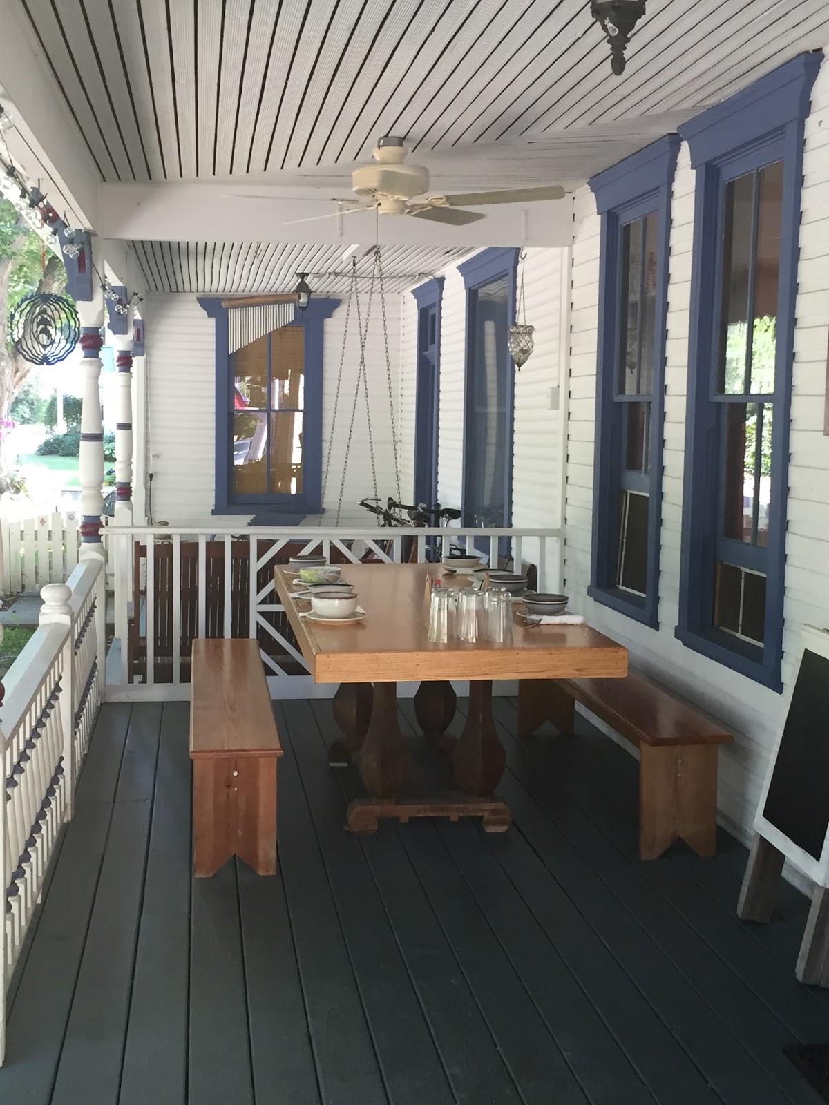
Kate made the Artisan bread from scratch, which literally takes all day.  In fact, everything is made from scratch.  As I ate, a gentleman sat down at a neighboring table to eat.  I found out later he was the owner and he was waiting for his wife to pass by in her raft on the river so she could meet him for dinner.  We had a nice conversation about the river and the release of the Dam, how the water would rise and the rocks I could see at the time would disappear at the 5:00 timeframe, and how the boaters I would see soon would be because they are just ahead of the water flowing from the Dam.  We also spoke about Friendsville – how he had passed by the town’s exit for decades not even knowing the little “village of people and activity surrounded by trees and water tucked away” was even there.  I agreed it is the best kept secret.
 
Looking at the time, I decided I should probably start my 3 hour journey home.  I absolutely did not want to leave.  Friendsville is so much more than a sleepy little town tucked away in the mountains or just a place housing gas for a critical fill-up.  It is balance and perfection.  I will definitely be back for a longer stay.


Saturday, July 11, 2015

E is for East New Market, Maryland

E is for East New Market, Maryland. 
I only had to drive 1 ½ hours to reach another delightful town which holds some more of Maryland’s fascinating history.  East New Market (click here for a map) is located in Dorchester County.  It was incorporated in 1832, has a population of 400, and covers an area of 0.4 square miles.  The town was originally settled in 1660 and is home to architecture depicting design from three different centuries.   One of the interesting things about this town is at each of the four entrances to the town stands a church.  
East New Market was the first town to receive the designation as a Historic District in Dorchester County by the State of Maryland.  Not only is it registered as a National Historic District, the entire town is listed on the National Register of Historic Places.  Additionally, in 1803, the word "East" was added to the town’s title with the establishment of a post office.  The change was made by the U.S. Postal Service to distinguish it from the town of New Market in Frederick County, Maryland.   
Now about my memorable experience.  As I was researching the town, I came across an article which read about a VERY historical event which occurred in this town in October 2014.  What was the event you ask?  I am afraid you will have to remain in suspense a little while longer.  However, I will tell you it was an event which was a long time in the making and should have come to fruition a lot sooner than in 2014.  On to my story…..

I arrived to East New Market wanting to at least drive by a few of the historical homes in the town.  Unfortunately, if they were not currently occupied by residents, they were abandoned and locked up, or they were used in another capacity (storage facility).  So, I drove by “Buckland”, the “Edmondson House”, the “Brick Hotel”, and “Friendship Hall”. 

Buckland (circa 1740).  This house has significance for several reasons:
"Buckland" is a rare structure for the Eastern Shore of Maryland.  First, the two-story, center hall house is a rare survival of eighteenth-century construction with intact layers of flush beaded weatherboards and superb interiors of raised panel carpentry.  Second, the overall shape of the house follows a "salt-box" form, a type of structure uncommon to Dorchester County and the Eastern Shore in general.  The long sloping rear shed covered small rooms probably used as chambers or service spaces.  Perhaps the most noted interior feature not found in many eighteenth-century Eastern Shore frame dwellings is the sophisticated ceiling plaster decoration.  Also, "Buckland" is clearly the oldest frame building to remain standing in East New Market. Its preservation was undoubtedly due to many reasons, but its superior construction on a well ventilated high foundation has prevented major failure of the substructure.  "Buckland" is thought to have been erected to face the old road, now Railroad Avenue, which was originally developed during the seventeenth century from an Indian trading path."

Edmondson House (circa 1799).  So, there is a pretty interesting story with regards to this house.  In short: 
 “[Back] in 2002, the current owner of the “Edmonson House” was in the process of renovating an upstairs bedroom and after remaining panels from the walls, he began scraping the paint and underneath he found approximately 30 signatures written on the wall, circa 1835-1837.  Some of names were local to the area while others were from out of state.  In addition to names, counties, states, and dates were included for several names.

The “Edmonson House” is approximately 600 feet from “Friendship Hall”, the home of Thomas Holliday Hicks Maryland's Governor from 1858 to 1862.  Local historians had heard of a tunnel behind the “Edmonson House” which, reportedly, connected the house to Friendship Hall.  Local legend stated the tunnel had been used on the Underground Railroad and the “Edmonson House” was once owned by Quakers.  The Quaker connection, along with the proximity to the Delaware border made the connection to the Underground Railroad very possible.  Many of the names were difficult to read due to their age and the poor lighting conditions in the room.  After moving a large bookcase from the short wall immediately to the right of the doorway, several more names were discovered.”

There is so much more regarding the historical background of these signatures in the “Edmondson House” article – I would encourage each of you to open the link and discover the rest for yourself. 

The Brick Hotel (circa 1787).  The “Brick Hotel” was once known as the “House of the Hinges”.  Colonel Joseph Daffin, a merchant, built the house between 1796 and 1798. He and his wife both died in 1798. It also belonged to Major Anthony Manning, an Officer of the War of 1812.  There are many fine period architectural details still existing in the “Brick Hotel”.  The structure got its interesting name "House of the Hinges" because of an unusual set of hinges found on a meat house at the rear of the building.  Unfortunately, since the set of hinges were not available for public viewing, I will never know what was so unusual about them.  Additionally, the house boasts a 1 ½ story "kitchen wing” (my dream kitchen).

Friendship Hall (circa 1783).  This house left me captivated.  I had to drive down a little driveway and when I reached the end of the drive, I was humbly greeted by an impressive, no…REGAL! dwelling.  I anxiously wanted to view the interior, but it is currently in a restoration phase by its current owner and not eligible for touring.  A description of this home, taken from “Souvenir Program of the North Dorchester Heritage Festival, June 5-11, 1955” reads:

“Major James Sullivane came to America [from England] with his two brothers about 1695 and settled here on the Eastern Shore.  Major James purchased land for the sum of $600.00 and built a brick mansion named "Friendship Hall".  Friendship Hall was the scene
of much of the splendid hospitality so characteristic of the colonial period.  The owner had a private racetrack and kept a number of fast horses for riding and driving.  The house itself was elaborately decorated, with crown moldings in each room and one with Greek key letter molding.  Paneled fireplaces extend to the ceiling, and paneled inside doors with brass box locks, are still the marvel of visitors today who go through the ancient rooms.  Friendship Hall remains one of the most beautiful remaining examples of colonial Dorchester.  The early owners and their descendants occupied high positions, and intermarried with some of the most noted families in the state.”
By now, you are probably wondering when I am going to talk about this 2014 historical event I mentioned earlier, right?  I apologize, but now it is time for lunch.  I ask that you accompany me to the “Hometown Pride Market and Deli” for a sandwich.  And what a delicious sandwich it was!  When I arrived, I found the store to be charming.  It was a combination grocery store/liquor store/scaled down Office Depot/copying room/deli all rolled into one.  The people who worked there, along with the customers, could not have been friendlier.  I was greeted with smiles, welcomes, and a little bit of conversation.  The sincerity of everyone and the “feel good” surroundings made my veggie sandwich taste even better.  I actually wrote down what I had on the sandwich so I could replicate it.  It was not a regular sandwich.  It started out with bread, lettuce, and tomato and it was built from there. 
So, here we are in the point of my adventure where I now talk about the 2014 event.  The event actually is a result of Harriet Tubman’s sacrifices she made for her family and friends.  For 200 years until 1864, Maryland sanctioned slavery.  Harriet Tubman was born a slave in Dorchester County in 1822 and successfully escaped to Philadelphia, Pennsylvania in 1849.  Wanted by law enforcement and slave catchers, she returned to Maryland 13 times repeatedly to rescue 70 of her enslaved family and friends.    Harriet used the network of people, places, and routes assisting escaping slaves reach freedom, which was known as the Underground Railroad (named after the new steam railroads and using terms such as “passengers” and “conductors). 
The Harriet Tubman Underground Railroad Byway is a “National Road,” which means it has been designated one of the country’s best byways for its historic and cultural value. The Byway also includes the Harriet Tubman Underground Railroad National Monument, lands designated by President Obama in 2013.  The 125-mile Byway includes more than 30 sites.   One of those sites is the Faith Community United Methodist Church in East New Market – the second oldest church in Dorchester County.  In October 2014, there was a ceremonial ribbon cutting and an historical marker placed in front of the church to confirm the church’s inclusion in the Harriet Tubman Byway.

As history tells, Samuel Green, born around 1802, was an African-American slave, freedman, and minister.  According to historical data, he helped Harriet Tubman and other runaway slaves reach freedom.  In 1843 a free black woman, Sarah Young, deeded land to seven free black trustees, including the Rev. Samuel Green.  Rev. Green and the original church trustees established the Colored People’s Methodist Episcopal Church in August 1844, in East New Market.  That church, now the Faith Community United Methodist Church, is he second structure to house this continuously active congregation. The original church site has recently been reacquired by the congregation.
Rev. Green was arrested in 1857, not for aiding the Underground Railroad but for having a copy of Harriet Beecher Stowe’s book, “Uncle Tom’s Cabin,” considered an “inflammatory” abolition document. He was sentenced to 10 years in prison.  Abolitionists called for his release and slaveholders called for his incarceration.  He was released in 1862 and, after a stint in Canada, returned to Dorchester County where he was an active member of the Delaware Conference of the Methodist Episcopal Church until his death in 1877.
Per Lay speaker Michelle Nichols said [on the day of the 2014 ceremony]:
     "On behalf of our pastor, the Rev.Beverly Holland, we are excited about what God has done.  We're honored to partake of this occasion 
       and be here to witness the fruits of the labor of this committee.  It's remarkable to have such a prominent piece of history here and a
       marker that will be here for generations to come so that our children and our children's children will learn and understand our history. 
       We are part of a rich legacy and history.  It's so important to pass that along."
Sometimes experiences and discoveries in towns like these will leave you awestruck.  I enjoy knowing a lot more about a town’s “days-gone-by” and knowing I had been standing on the same spot where significant, historical events occurred.  It leaves me with a deeper appreciation and admiration for the people in our past who shaped the history of this country. 


Tuesday, June 30, 2015

D is for Deal Island, Maryland

D is for Deal Island, Maryland.   Making the 2 ½ hour drive to the town I personally nicknamed “Mayberry by the Bay” was not difficult at all (click here for a map).  My interest in visiting this town was prompted by wanting to see one of the few remaining working Skipjacks left in the world.  You are probably wondering what a Skipjack is, right?  Ah, you are just going to have to wait!

Deal Island is a Census Designated Place (CDP), which is a populated area lacking a separate municipal government, but which otherwise physically resembles incorporated places.  It is located in Somerset County and is included in the Salisbury, Maryland statistics.  Deal Island has a population of 471 and covers an area of 5.4 square miles - 3.2 square miles of it is land and 2.1 square miles of it is water.  Historically, it was known as Deal’s, Deil’s and Devil’s Island.  At least one source also attributes these nicknames to the area’s use by pirates.  

I found to be this to be an accurate description of Deal Island:  Deal Island is one of the last Bay type water and land mosaics on the East Coast left unblemished and untouched by the sprawl of modernism.

As I got a bit of a late start on my journey, lunch was the first order of business when I got to Deal Island.  I read earlier there were two restaurants to choose from, so I decided on a place called “Arby’s General Store”. 
Arby’s is a three part store – beer/bait/tackle; restaurant; bar located across from the newly-refurbished public marina.  As I found out, it is not only the “comings-and-goings” of the Maryland eastern shore fishermen and the trappings of a real fishing village that makes this place special, it is the food.  Arby’s has a varied menu with excellent food at modest prices.  It is a great place to eat if you are going on a fishing charter or you have a boat you are launching from the marina/boat ramp across the street.  As it was lunchtime when I got there, I was hoping to see some of the fisherman unloading their catch as I got to the restaurant.  I did, but not until I finished eating.

Initially, I was the only person in the restaurant-bar area (“areas 2 and 3” of the establishment).  About 10 minutes later, I saw some fisherman walking over from their recently docked boats.  The woman acting as cook/waitress/busboy/barkeep motioned me to sit down where a menu was already on the table.  As always on my visits to these small towns, I wanted to order something local.  As I am a fish/no red meat/no chicken eater, I settled on a Crab Burger (with no bun), which was described as crab meat, spices, and cheese.  In my mind, I’m thinking I would be getting something similar to a crab cake.  Wouldn’t you?  What I actually got was a hamburger patty, topped with crab meat, spices, and cheese!  BIG DIFFERENCE!!!!!  I simply ate everything but the hamburger - it was still delicious and filling.  Lesson learned – ensure you know what you are really getting before you order!

As I was getting ready to leave, an older gentleman walked by, smiled, said “hi”, and continued on back to the beer/bait/tackle area of the store.  Since water was sold back there, I decided to check out “area 1” and make a purchase.  I complimented him on his hat (Bacon Lover) and he proceeded to have a conversation with me – beginning with the history of the hat.  I found out his name was Arby – the owner of the store(s).  He was extremely proud to tell me he has been working in the store for 31 years.  He was born in the house that once stood in the backyard of the store and lived in there until 2003 when Hurricane Isabel struck and generously deposited 20 inches of water in the house, condemning the structure.  It was then demolished and he moved about a block down the road.  He joked the move increased his commute time, but he has a better view of the Bay.  As I was talking to him, locals kept coming in, friendly “hello’s” were thrown about (by name), and if someone wanted to exchange something (i.e., lures) or return something, he would always add on an imaginary “Restocking Fee” to the refund.  Arby was extremely entertaining with his stories – I could have easily listened to what he had to talk about for many more hours. 

However, I needed to start my adventure and at this point I asked Arby about the Skipjack.  Before I continue with what Arby had to tell me, here is a brief description of a Skipjack (per Wikipedia):

"The Skipjack is a traditional fishing boat used on Chesapeake Bay for oyster dredging.  It is a sailboat which succeeded the Bugeye as the chief oystering boat on the bay, and it remains in service due to laws restricting the use of powerboats in the Maryland state oyster fishery.  Due to state laws, the boat has no motor (other than for the windlass).  Most skipjacks were eventually modified with stern davits to hold a dinghy or pushboat to allow motorized travel as permitted by law. The Skipjack arose near the end of the 19th century.  Dredging for oysters, prohibited in 1820, was again made legal in 1865. Boats of the time were unsuitable, and the Bugeye was developed out of the log canoe in order to provide a boat with more power adapted to the shallow waters of the oyster beds.  The Bugeye was originally constructed with a log hull, and as the supply of appropriate timber was exhausted and construction costs rose, builders looked to other designs. They adapted the Sharpies of Long Island Sound by increasing the beam and simplifying the sail plan. The result was cheaper and simpler to construct than the Bugeye, and it quickly became the predominant oystering boat in the bay.


Maryland's oyster harvest reached an all-time peak in 1884, at approximately 15 million bushels of oysters.  The oyster harvest has since declined steadily, especially at the end of the 20th century.  The size of the fleet has likewise declined. New Skipjacks were built as late as 1993, but a change in the law in 1965 allowed the use of motor power two days of the week.  As a result, few of the boats are operated under sail in commercial use; instead, a pushboat is used to move the Skipjack, and little dredging is done except on the days power is allowed.  At one time, the number of Skipjacks produced is estimated at approximately 2,000; today, they number about 40 with less than half of them in active fishing.  The future of the fleet remains in doubt as efforts continue to restore the productivity of the oyster beds.  The Skipjack was designated the state boat of Maryland in 1985".
 

Arby told me there was a Skipjack located across the street in the marina.  Her name is Fannie L. Daugherty which was built in 1904.  She is one of the 35 surviving traditional Chesapeake Bay Skipjacks and a member of the last commercial sailing fleet in the United States.  He continued to tell me Skipjacks are not permitted to harvest oysters until 1 November whereas the smaller boats are permitted to harvest on 1 October.  Arby also told me there was another Skipjack nearby.  He took me outside, pointed across the harbor, to the tall mast in the distance.  Arby told me the Skipjack named City of Crisfield (built in 1949) is captained by Captain”Daddy Art” Daniels, a 93 year old Skipjack captain who is the oldest captain still working the Chesapeake.  I asked Arby if he thought Captain Daniels may be over at the Skipjack so I could talk with him, but Arby said probably not because it was getting quite warm out.  We finished the conversation with Arby telling me about the Annual Skipjack Race occurring on Labor Day Weekend where usually 7 or 8 Skipjacks would be racing.  This year would be the 56th year for this spectacular annual event and it is hosted by the Deal Island Chance Lions Club.  I told him it would be a strong possibility I would be back for the event, thanked him for his hospitality, and walked across the street to see the Fannie L. Daugherty.  I also wanted to see if any boats were coming back with crabs.

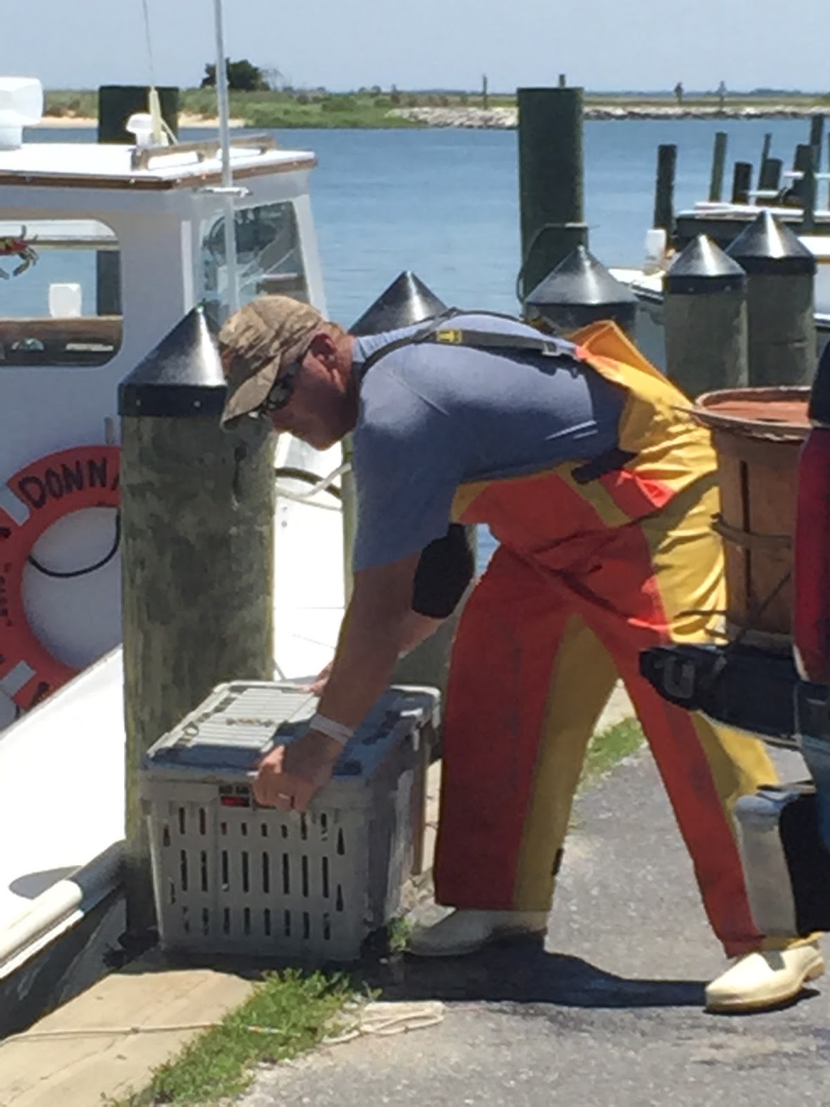
The Fannie L. Daugherty was beautiful!  Remembering she was built in 1904, she looked practically new and it was evident she was well taken care of.  The mast was beyond impressive and I can only imagine the sight of her when she is in full sail.  As I was snapping pictures of her, a commercial fishing/crabbing boat pulled into the docks.  I made my way over to the boat and saw it had quickly docked and the fishermen were unloading countless crates and bushels of crabs onto the back end of a pick-up truck.  Lots and lots of Chesapeake crabs!!!!  The driver then got in the truck and drove away.  The entire operation (likely, routine) was over in what seemed like a few short minutes.

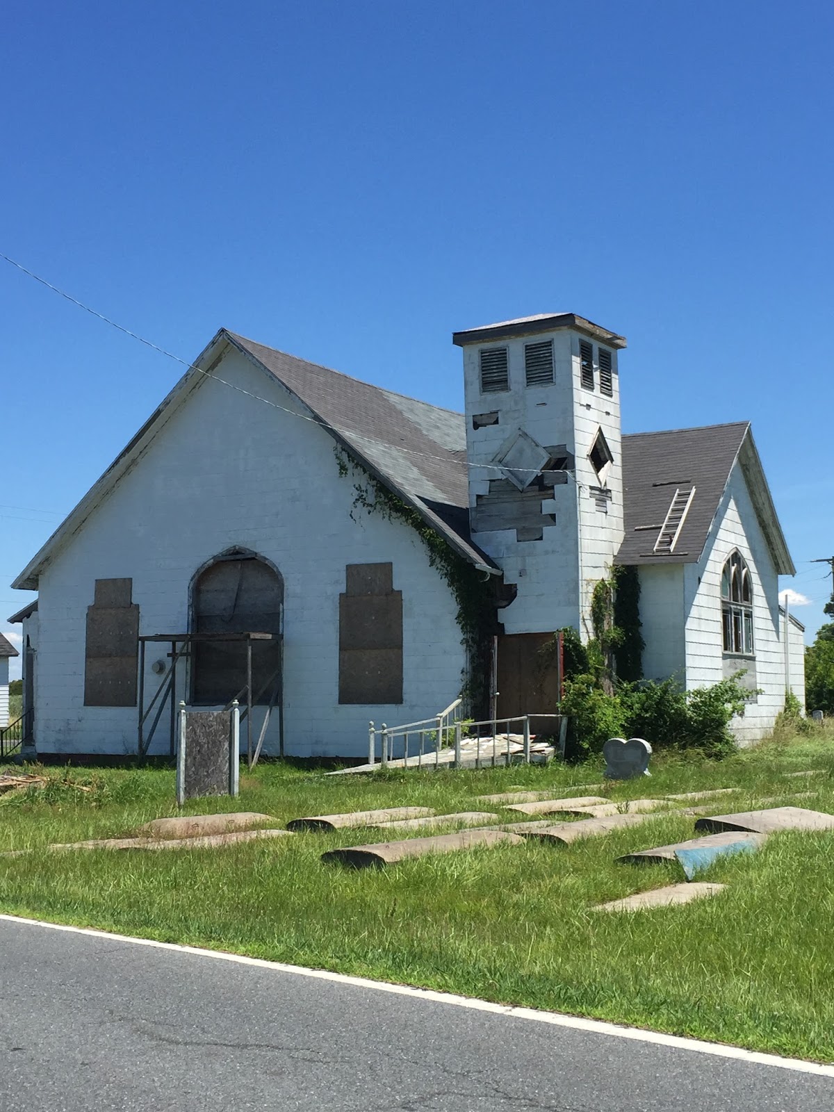
I had one more stop to make – The Deal Island Wildlife Management Area (WMA).  On the way, I passed “The Deals’s Island 1908 Bank Building”, which is For Sale by Owner.  I also passed a church with a sign out front reading, “The John Wesley Restoration Project”.  After careful research, I found a short article in addition to a Facebook post, which read:

An article written in February 2013 about this church and cemetery:  “John Wesley United Methodist exhibits some greater past that’s been forgotten, neglected.  The church was once a cornerstone of the African American community on the island, but declining membership caused it to be shuttered, and a decade of neglect shows in the glass-less windows, and the cracked and waterlogged cemetery vaults.  A restoration effort appears not to have picked up much steam.”


Facebook post:  "Efforts are under way to help preserve the only remaining African American Church, on Deal Island, Maryland.  This Church is in desperate need of repair and if we don't act now the building will fade away."

I was able to roam around the small church yard and found some graves in the adjoining cemetery to be those of fallen Soldiers.  Sadly, there were also some small torn flags lying about the grave sites.  It would be wonderful if the grounds could be cleaned up in the near future.

On to the WMA.  What is the WMA, you ask?  Here is a little information about it:

"Expanses of tidal marsh, frequently broken by open water, characterize most of the habitat of this WMA. The 13,000 acre property also contains forested wetlands and a 2,800-acre man-made pond or "impoundment."  The water insects and crustaceans, as well as the abundance of Wigeongrass, Horned Pondweed and other favorite waterfowl foods makes Deal Island one of the best places in Maryland to watch, photograph and hunt ducks and geese.  [Basically] ducks, geese, swans! Waterfowl are the featured performers on Deal Island.  Many, many species of waterfowl, in all their colorful splendor, nest, feed, and migrate through this area.  Deal Island also supports one of the largest concentrations in the state of Herons, Egrets and Ibis.  One of Maryland's only breeding population of Black-Necked Stilts thrive here. The rare Eurasian Wigeon, a type of duck, is frequently seen in the large flocks of American Wigeon that spend the winter in Maryland".

I read you could park and walk the gravel/dirt road into the area.  However, the area began immediately as you turned off of the main road and there was not a parking lot I could find, so I decided to drive the one lane road.  I found the reeds and Cattails came right up to the sides of the road I was traveling, so if another car was coming from the opposite direction it would be a VERY tight squeeze and a very strong possibility one of us would probably go into the watershed!  Luckily, I was alone on the small road the entire time and what an experience.  I had the entire WMA to myself!  Cranes, Loons, and even a couple of Bald Eagles held my gaze along with plenty of Red Wing Blackbirds.  I never saw a Baltimore Oriole, though.  I have always hoped to see one since moving to Maryland, but never had the luck.  I read Orioles were pretty prevalent in the WMA, but they must have been playing an Away Game today!!!  I quietly drove the road for roughly ½ hour, was able to find a place to successfully turn around, and got back on the main road to head home.  I wish I could have stayed longer, but then I always do when I visit these types of places.  I “will” be back, though!

Earlier, I mentioned I personally nicknamed Deal Island “Mayberry by the Bay”.   The people were down-to-earth, charming, and friendly - I was made to feel welcome by everyone I came in contact with.  The slower/relaxed pace of life on the Bay is something not many people will ever get to experience, and I feel fortunate I had the rare chance to be afforded this opportunity.  Deal Island is definitely a hidden gem worth exploring!    

In memory of my friend Tom – a model Soldier and family man I had the honor and privilege to serve with.