Sunday, August 4, 2019

 
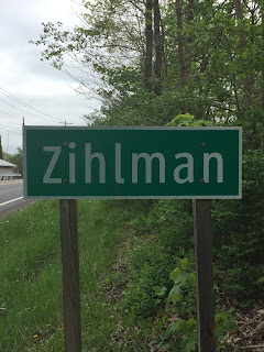
Z is for Zihlman (click here for map).
It took approximately 2 ½ hours to travel to an area in Maryland I knew absolutely nothing about, and I was prepared to get educated. What was the subject matter? Coal. And how did I get to the very rural town of Zihlman? I had to travel on MD 36, which the Maryland State Highway Administration designated as part of the Coal Heritage Trail – State of Maryland Scenic Byway. Very cool.

Zihlman (formerly “Allegany”) is an unincorporated community and census-designated place in Allegany County. The town has 362 residents, occupies a total land area of 1.5 square miles, and sits at an elevation of 1,591 feet. The town was established shortly after the Allegany Mining Company opened in 1846. As mentioned earlier, the town was formerly Allegany – the name was changed to Zihlman in the early 20th century. 

Zihlman is part of
George’s Creek Valley. This valley is rich in wide veins of coal, known historically as "The Big Vein." Back in the 1800s, the Bituminous Coal of “The Big Vein”, in the regional coal mine, was once extracted from deep mines.
Today, it is only mined through surface mining. The George’s Creek Valley was once a major center for the U.S. coal industry. Since regional coal mines were constructed with horizontal shafts, they were far less dangerous than the vertical shaft mines of Pennsylvania and West Virginia. Still, the regional miners blackened from head to foot when they emerged from a mine at the end of a day, knew that the carbon-filled air, which corroded the lungs over time, would lead to an early death. 

After the
Civil War, coal became one of Maryland's chief products and exports. Coal from the George’s Creek Valley fueled the State's mills and plants, steamships in Baltimore's harbor as well as the U.S. Navy fleet, and was traded to buyers from overseas. Primarily Scottish and Welsh immigrants provided the labor force for these mines immigrating with their families for the opportunities America offered.  

When I arrived at Zihlman, I was immediately greeted by the homes of the Zihlman-Allegany Mines Survey District.
Part of the Survey District
Most of the buildings within the survey district were houses representing one of three types: the
Saltbox House (also known as Coal Camp Houses), the Duplex “Block House”, and the Vernacular-Styled House.  

Before I continue, you may be wondering if Zihlman was once a
company town since a 
Example of a Saltbox House
mine had to be built where the coal was – often in the “middle of nowhere.” Even if the miners could afford to buy or rent, there were not any houses for miles around. So, the coal company had to build a whole town for its workers. The company even built a store forcing the miners to purchase all their supplies and household needs from the mining company.  

It is important to note that Zihlman was not a company town. A high proportion of miners were also homeowners as local mining firms found it more profitable to sell houses to their miners.
Example of a Duplex "Block House"
Additionally, the company town store system was outlawed in Maryland in 1868. 

After slowly driving along all three streets of the survey district, I decided it was time to go and find the mine - Union Mine No. 1/Broken Hart Mine. As the streets were adjacent to the mine, I thought it would be easily located. I was sadly mistaken.

Union Mine No. 1/Broken Hart Mine was once a
drift mine. This meant the coal was retrieved by cutting into the side of the earth (by pick and machine), rather than tunneling directly downwards. This type of mining is performed when the rock or mineral is on the side of a mountain. This makes it a simple, economic way to mine. The tunnels that are excavated are horizontal and are known as drifts.
Drift Mine Illustration (courtesy of earthandscience.blogspot.com)

Fun fact: In 1913, this mine employed 132 individuals who worked 278 days that year. The mine produced 79,182 tons of coal by pick and 21,218 by machine making a total of 100,400 tons for year.

As much as I wanted to see the mine, there was not a trace to be found. The “Big Vein” was exhausted by the 1920s, operations ceased, and the land underwent mine reclamation.
Mine reclamation is the process of restoring land that has been mined to a natural or economically usable state. Although the process of mine reclamation occurs once mining is completed, the planning of mine reclamation activities actually occurs prior to a mine being permitted or started.

Bottom line: When mining ends, operators must restore the land to its approximate original contour or leave the land graded and suitable for a “higher and better” post-mining land use that has been approved as part of the original mining permit application.


Although the mine was no longer visible, I was hoping to at least find evidence of the tram that ran through the town. The tram hauled coal, materials, and men up the mountain to the mine.  When I was conducting research on Zihlman, I came across a
map of the tram track. However, it proved more difficult to find the actual track than it appeared on the map. There was a road labeled “Broken Hart Mine”, which was one of the three roads in the survey district. That was a good place to start, right?

I drove up and down that road several times looking around – no luck. Hmmm……..maybe I was on the wrong road. So, I drove up and down the other two roads in the district. Still no luck. I was just about to give up, when I decided to try Broken Hart Mine road, again. I really needed to find this track as the neighbors were probably wondering if I was a stalker!

Tram Track
At the end of Broken Hart Mine road, there was a small dirt road veering off to the right, so I took it.  A few minutes later, victory! I found something that resembled what once was/could have been a tram track. Here’s an idea: Follow the tram track and maybe I will find the mine, right? No bueno. This particular portion of the tram track ran through a heavily wooded area and was on private property so……..

Pumpkin Hall or Kroll Log House
Happy I found what I thought was the tram track, I worked my way back through the survey district where I came across “Pumpkin Hall” – also known as the Kroll Log House (circa 1806). This structure is the only building in the George’s Creek Valley that is whitewashed rather than covered with siding. This is an early method of finishing log buildings, which is mainly utilized until the occupant could afford siding. Such treatment is rarely seen today.

Hunger was calling, so I decided to head over to
Blank’s Tavern (formerly Annette’s Bar and Grill).
I was seated in the bar area and thought I was by myself until I heard a party going on in the adjoining room. Minutes later, I found out a weekly “Texas Hold ‘Em Poker Tournament” was in full swing. I was asked if I wanted to participate, and politely said “no”, as I would probably be on my phone CONSTANTLY Googling the rules and what-beats-what throughout the game. Hopefully, you can figure out that I am not a Poker player! I am more of a “Go Fish” type…….Haha!

Kaiser Refractories Plant

After lunch, I wandered over to the Kaiser Refractories Plant – a clay brick plant. Built in 1902, the Big Savage Fire Brick Company built the plant to take advantage of the valuable clay reserves on the property. Oh! And there was definite evidence of what they used the clay for – bricks, bricks, and more bricks!!

Essentially, a fire brick, firebrick, or
refractory brick is a block of refractory ceramic material used in lining furnaces, kilns, fireboxes, and fireplaces. A refractory brick is built primarily to withstand high temperature, but will also usually have a low thermal conductivity for greater energy efficiency

Here is the timeline of the Refractories Plant:

This local
fire clay was first discovered in Mount Savage, MD in 1839 and the Mount Savage Fire Brick Works began operation in 1841. This same company was incorporated as the Union Mining Company in 1864.
Lots and lots of bricks!
In 1944, the Union Mining Company was sold to Andrew Rost who operated the works as the Mount Savage Refractory Company. This was taken on by his son, Robert Rost until 1987, when the Mount Savage plant closed. The company moved to the Kaiser Refractories Plant in nearby Zihlman, MD, which still operates today.


I left the Plant and made my way over to
Switch No. 9, which is an integral part of the railroad system running through western Maryland. The switchover from the Western Maryland Railway to the Cumberland and Pennsylvania Railroad still occurs at Switch No. 9 today. The train itself remains the same – only the name of the railroad changes at this point.
Merge of WM and C&P Railroads
Basically, to make a train change its track, a special mechanical arrangement is made. This arrangement is known as a Railroad Switch and it consists of pair of rails, known as switching rails or points, that are linked to one another. As the name suggests, switching rails can direct or guide the train, either on a straight path or on the diverging path, which is established by a curved rail line.

The
Great Allegheny Passage Bike Trail runs along the side of the railroad – similar as how a towpath runs along the side of a canal. I found the railroad (and obviously the bike trail) but could not figure out how to access the area. 
Great Allegheny Passage Trail
I must have driven for 15 minutes trying to find an access point, but never found one. So, I went back up to the road/bridge that crosses the tracks and drove down the steep bank leading to the tracks! And it’s not like I had a large truck - I was driving a very small car, which I don’t normally take off-roading. Luckily, the bank was not soggy, muddy, somebody’s backyard, or so steep it would cause my car to roll!


Thankful my car and I arrived in one piece, I got out and started walking along the bike trail. As luck would have it, my parking spot was only ½ mile or so from Switch No. 9! I walked over to it and just stared. How cool!
Switch No. 9


So, there I am standing in the middle of an ACTIVE train track for several minutes staring at the switch and running through my head how it worked when someone on the bike trail yells, “Throw!” I looked up and both of us laughed. It was at this moment I decided that I probably should move off the track in the event a train were to appear. The individual (jokingly) yelled, “Throw!” because he was referring to what someone does to the Switch to have the train switch rails. Much as I would have liked to do this, I thought better. Lord only knows where that train would have ended up! Haha!


It was getting late, so I walked back to my car trying to figure out if I was going to successfully make it back up that steep bank. I’m not going to lie. I was a little nervous. And guess what? My little car made it (note to self……send performance review to car company!) Whew!


Today was a very educational day, but I was still able to relax and take in the quiet of what used to be a bustling mining town. Zihlman is a lesser-known town in Maryland and you probably never heard of it, but it certainly has a story worth telling.
Jennings Run - Maryland tributaries to Three Forks Run & Wills Creek (North Branch Potomac River)

Tuesday, April 25, 2017

Y is for Y-Junction

Y is for Y-Junction or a “fork in the road”

Fork in the Road
– a perfect descriptor of my situation in trying to decide which “Y” town to write about.  Do I write about the obvious?  The ONLY town in Maryland beginning with the letter “Y”?  Or do I go against the norm?  The great New York Yankees manager Yogi Berra famously said, “When you come to a fork in the road, take it!”  So, I did…..

My decision involved two towns - Yarrowsburg and Wye Mills.  I know, I know…..Wye Mills begins with the letter “W.”  However, the word “Wye” sounds like the letter “Y” and pronounced like the word “why.”  Although Yarrowsburg fit my tiny town criteria (population 141) and is historically significant, no buildings, structures, events, or food choices of note were available.  Ultimately, I made the decision to write about Wye Mills. 

However, I would like to recognize Yarrowsburg as the sole area in Washington County named for an African-American - Polly Yarrow.  Polly was a highly regarded 19th-century midwife living nearby.  If you are interested in reading more about Polly and her family, James H. Johnson’s book From Slave Ship to Harvard is the true story of the six generations of an African-American family in Maryland, which is actually about Polly’s father-in-law - Yarrow Mamout.  In this book, Mr. Johnson traces Yarrow’s family from the colonial period and the American Revolution, through the Civil War, to Harvard, and finally today.

My route to Wye Mills was short
– less than 45 minutes.  Located on the Maryland’s Eastern Shore, Wye Mills is an unincorporated town located in Talbot County situated just 20 feet above sea level!  It is home to 400 people who continually keep a strong sense of the town’s past alive. 

The town of Wye Mills evolved from a mill town that supplied General George Washington’s troops at Valley Forge with ground wheat during the American Revolution.  How did Wye Mills get its name?  The name originated from the two grist mills and one sawmill originally located at this crossroads between Talbot and Queen Anne’s counties (only one grist mill now stands.)  In 1706, Queen Anne’s County was formed out of Talbot and Kent Counties, and the existing grist mill served as a primary survey point on the dividing line between 
Wye Grist Mill Marker
Talbot and the new county of Queen Anne’s.  Therefore, the mill straddles the county lines.  This mill is the Wye Mill, which has been in near constant operation since 1682.  More about the Wye Mill in a bit…..

I arrived in Wye Mills eager to work on my “To See” list.  Within a few minutes, I saw the Old Wye Church.  Since 1721, 
Old Wye Church
the Old Wye Church has been standing alongside the main road going through town.  Originally, it was part of St. Paul’s Parish in nearby Centreville as one of the
thirteen Establishment Act parishes of 1692.  The present Wye Parish was created in 1859 out of the original St. Paul’s Parish. 

The Church was extensively renovated in 1854, and in 1947, restoration efforts began again with a service of rededication taking place on 13 July 1949.  Because of vestry notes from 1723 recording how the church appeared when it was built in 1721, more information was available for the Old Wye Church restoration than for any building in historic Colonial Williamsburg!  
Hanging Side Pulpit and Box Pews
The notes gave insight into the description of
box pews, a hanging side pulpit, the reader’s and clerk’s desks, and many other details.  The Palladian window behind the altar was included in a sketch of the original interior.  Also included in the sketch was the Royal Arms on the gallery.  The Royal Arms is a feature of churches representing the monarch’s role as head of the Church of England.  The Arms could have been made in the form of a painting, embroidery, wood, stone, or iron.    

I reached the old church and found it to be elegant in its simplicity.  This still thriving, nearly 300 year old Episcopal church was very well-maintained.  However, before conducting a closer look at the historic sanctuary, I decided to take a short walk around the grounds admiring the calm, serene retreat and paying respect to those buried in the adjacent cemetery.  The entrance is actually at the church’s rear facing away from the main road and parking lot.  The view from the entrance was amazing!  There was a long brick walkway leading to a tranquil sitting area.  The area overlooked a wooden bridge crossing into an open meadow where a beautiful surprise awaited.

Waiting for me was a 5 ½ foot tall wooden Celtic cross.  After being mounted on its base, 
Celtic Cross
the cross rises 7 ½ feet above the ground, and is easily visible to everyone coming out of the church.  This particular cross has very special meaning to the church (and the town) as it was fashioned out of a piece of the Wye Oak.  You will figure out what I am talking about as you continue to read.   


Walking back towards the church, I was hoping (and praying) it was open.  As luck would have it, the door was open, so I went in and looked around.  The interior was absolutely beautiful.  As with the outside, the inside had that same simple elegance.  What instantly caught my eye were the box pews.  I had never seen these before and I absolutely loved the hinged doors.  However, I realized that some of the 
Altar
people sitting in these pews would have their backs to the altar.  I wondered if this was a concern to the parishioners.  If you have the time and you are interested in the fascinating history of pews, benches, and chairs in a church, please access
this periodical.  An excerpt from page 271 of the publication addresses my concern:

Facing each other in a square box pew has the obvious disadvantage that some people have to turn their back on the [clergy], but much the same happens today in a secular context with the round-table seating arrangements we have at award ceremonies and business conferences, so perhaps it was not too disruptive. Nevertheless it incurred the displeasure of the Victorian church reformers, for all the obvious reasons.
The Old Wye Church is of the Georgian era (1714-1830) – a time when they used box pews.  
Box Pews and Royal Arms
The
Victorian era (1837-1901) followed and it appears box pews were no longer desirable, hence the use of benches in present day churches.  

Looking around, I saw the spectacular Royal Arms located on the front of the gallery.  These Arms are made of carved oak, are the church’s original, and were enormous!  Additionally, the Old Wye Church followed the custom for the Royal Arms to be located at the west end of the church over the west door. Without a doubt, the Old Wye Church’s very presence 
Old Wye Church Royal Arms
speaks exclusively to tradition. 
The next stop on my list was to visit the historic site Wye Mills was named for – the Wye Grist Mill (history of the mill can be found here and here.)  The Wye Mill is the oldest surviving grist mill on the Eastern Shore, is Maryland’s oldest commercial structure in continuous use, and is the oldest continuously operating water powered grist mill in the United States.  
Wye Mill
As mentioned above, the Wye Mill has been grinding grain since 1682.  In addition to its mill operations, the mill houses a small museum. 


The mill was not operating nor was it open for touring – I was just a couple of months too early.  It is open from mid-May through mid-November.  There are also specific grinding days, as well.  However, there were a couple of other displays on the mill property to see.  One of the displays 
Turbines
was the turbines the mill once used.  The concept behind a turbine is very similar to that of a waterwheel, except a turbine spins around a vertical axis and is powered by water pressure rather than gravity.  In 1916, it was determined that
(tidal) backwater in the
tailrace restricted movement of the water wheel, so the wheel was removed and replaced with two turbines.  In 1918, the mill was sold and the new owner discontinued the use of the turbines.  It was found the abundant sand and gravel underlying the mill property and tailrace apparently clogged the turbines.  
Pair of Wye Mill's Burrstones
As a result, the new owner reinstalled the original steel wheel.  A pair of the mill's old “
burrstones,” which worked with the turbines, was on display.  Once the turbines were removed, the stones were removed as well.

Another interesting display on the mill’s property was a replica of a typical Colonial-era “corn crib.” 
Corn Crib
The designated marker reads in part:

[This corn crib] was built as an Eagle Scout project in 2012 by Scott Bell.  It includes material reclaimed from a Colonial-era corn crib located on Kent Island, and is representative of what may have been used here at Wye Mill.  The granite blocks on which it rests are thought to be ballast from a 17th or 18th [century] sailing vessel. The wide boards on the ends of the crib are typical of the work done by 18th and 19th century water-powered saw mills such as the one that was in operation on this site from the late 1700's until 1875.

Saving the best for last on the property, I walked over to the Wye Mill.  As I stood looking at the impressive structure and thinking of its historical significance, two things filled my mind –admiration and awe.  
Wye Mill Water Wheel
Although I wasn’t able to take a tour (today), research allowed me to arm myself with some of the mill’s information for when I return during milling season.  During the months the mill operates, the floodgate to the creek is opened and twice monthly the milling begins.  The giant water wheel turns, the stones grind, belts spin, gears turn, rafters and beams creak, and the wheat and corn are ground exactly the way millers did back in the 1600s – it’s a step back in time. 


The museum shows three different ways to grind corn.  The first way may have been an American Paleoindian approach.  You have two rocks, 
Wye Mill Water Wheel
put a piece of corn on one rock, and you pound it with the second rock.  The second way is as the Wye Mill does - stones move against each other grinding the corn, which is a technique used since Ancient Rome.  And finally, there is fun, more modern-day approach involving dried corn, a “candy machine” with grinders, and a quarter.  The “candy machine” is filled with dried corn and for a quarter you get to work the grinders and make your own meal.  The Wye Mill is a working piece of history I look forward to visiting in the near future.


From the mill, I wandered over to the Miller’s House located a few hundred feet away.  
Miller's House
This house dates back to 1740 and served as the residence for the miller.  Currently, the house is vacant and isn’t in the best condition.  Plans have been in the works to restore this house to its original beauty. 


Now, I would like to talk about a unique food item that has been a classic Mid-Atlantic tradition stemming back to the plantation era.  Am I talking about the Maryland Blue Crab?  No.  Natty Boh beer?  Again, no.  I am talking about the beaten biscuit.   Unfortunately, these biscuits are no longer commercially produced.  However, I would like to describe how they were made.  The cardiovascular workout experienced during the preparation of these biscuits is well-known.  
Beaten Biscuits
The dough is placed on a wooden slab and beaten for at least 30 minutes with an axe handle, a wooden club, a hammer, or a rolling pin.  Beaten biscuits are not leavened, meaning, yeast is not used, so you have to beat them in order to incorporate the air that a leavening agent would normally add.  In fact, a sign that the dough has been beaten long enough is that you can hear the air bubbles that have formed begin to pop.  Additionally, classic marks left by fork tines in the top of the biscuit allow the bread to cook properly as well as give its distinctive appearance.  The finished product is a golf ball sized biscuit, which could be kept for a long time due to their sturdy nature; hard and stiff on the outside, doughy and chewy on the inside. 


I mention the beaten biscuit, because Wye Mills holds the distinct honor of once housing the world’s only commercial source of beaten biscuits in Maryland - Orrell’s Maryland Beaten Biscuits.  Founded in 1935 by Ruth Orrell, this business became a way to earn extra money in order to send her son, Dick Orrell, to college.  She made the beaten biscuits out of her kitchen and her husband, Herman Orrell Jr., delivered the biscuits to customers on his milk route.  Over time, Orrell’s biscuits became so popular they were making more than 10,000 of the little gems per week.  In 1960, Ruth was 
Former Location of
Orrell's Maryland Beaten Biscuits
still using her original hammer and had thoughts about closing the business – she was tired.  It was then a Baltimore patron made her a machine that mimicked the action of a hammer, so the business continued.  Unfortunately, the business finally had to close its doors in late 2013 with the death of Dick Orrell.  It had been in continuous operation out of the same Orrell kitchen for close to 80 years with every single biscuit made by hand. 


I read these beaten biscuits did not go "stale."  Instead they "dry up," which was a 10 day process.  Even then the biscuits were said to have several culinary lives left.  They could be pulverized in a food processor and put in a meatloaf, or used as breading for pork chops or chicken.  You could even make pancakes by mixing a cup of the ground-up biscuit crumbs with an egg, milk, oil and baking powder.  Apparently, they were very good.

Courtesy of Pinterest
By now you are probably asking for the recipe because you are craving a good old-fashioned upper body workout, right?  Unfortunately, some things are still kept secret.  The recipe was handed down through the Orrell family for many generations, and although the business is closed, family members will still not share the coveted recipe.  However, I am providing a similar recipe for Maryland Beaten Biscuits in case you would like to try your hand at making them.  The most important thing to remember about making beaten biscuits is the longer you beat the dough, the better the biscuit. 

Speaking of biscuits, I was hungry for lunch.  However, Wye Mills is not known for their commerce.  The one store the town had is now a residence.  Knowing this, I thought to pack a lunch and decided to head over to Wye Landing so I could eat by the water.  Wye Landing is a public boat launch for access to 
Wye Landing
the Chesapeake Bay for local boaters.  There is also a public park with picnic tables.  I decided to park in the lot leading to the boat launch as it was closest to the water.  I was also the only one there, so I had the quiet, peaceful view of the water, sun, trees, and birds all to myself.  It was the perfect spot to spend an afternoon.

Much as I would have loved to spend all afternoon at the landing, I needed to continue working on my "To See" list.
Schoolhouse
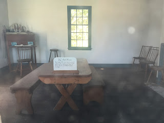
I began driving to the Wye Oak State Park.  This 29 acre State park protects the nearby stream valley from development and includes the Wye Oak Schoolhouse.  This is a small, 1 ½ story brick structure, which has been furnished and restored to its status as a colonial period one-room schoolhouse.  The building is recorded as the second oldest existing schoolhouse in Talbot County, Maryland.  In 1952, The Queen Anne Garden Club restored this little house strengthening the foundation, repairing windowpanes, and laying a new walkway.  They also restored the interior furnishing it with a period piece
Inside of Schoolhouse
schoolmaster’s desk and stool, a long pine table and benches, and a dunce stool.

The schoolhouse is not the only item of interest in this park - it sits in quiet memory next to an area where a giant once stood.  The giant I am referring to is The Wye Oak, which was declared Maryland’s honorary State tree in 1941.  This tree was the largest White Oak in the United States.  Sprouting in the 1500s, it was more than 460 years old, measured 31 feet, 8 inches in circumference, was 96 feet tall, and had a crown spread of 119 feet covering nearly 1/3 acre.  
Postcard of the Wye Oak
Tragically, the tree was destroyed by a severe thunderstorm on 6 June 2002.  It is believed that the acorn that became this tree germinated around the year 1540!  The Wye Oak was still bearing a maturing crop of acorns when it was toppled. 
Per wiki article:

Upon its falling, immediate efforts were made to salvage and preserve the tree's remains. 
Pieces of the tree that had fallen in previous years had been used to sculpt works such as the statue of two children planting a tree located in the Tawes State Office Building in Annapolis.  A very large section of the lost tree became a new desk for the Maryland governor's office.  Wood was also distributed to some 40 artists and craftspersons who have used the tree's remains to create carvings, sculptures, oil paintings, a 3-dimensional collage, furnishings, and serving pieces.

Remember I mentioned the Celtic cross at the Old Wye Church?  Here is a very interesting article about the history and the dedication of this cross.  The Wye Oak will definitely not be forgotten!

In 2012, the Maryland Department of Natural Resources (DNR) began offering the Wye Oak’s descendent seedlings for purchase.  
Pavilion with Section of Wye Oak
Thousands of Wye Oak offspring have already been planted not only across Maryland, but around the United States. The seedlings come with a Certificate of Authenticity and a history of the tree.  Without a doubt, there is a strong desire for this beloved tree’s history to live on.


The Wye Oak State Park has a beautiful pavilion, which memorializes the Wye Oak.  The marquee is located behind the area the massive 
Section of Wye Oak
tree once stood and pays an amazing tribute to a symbol of Maryland’s pre-colonial past.  On display is a section of the tree’s trunk 8 ½ feet tall, is roughly 8 feet at its widest point, and weighs about 5 or 6 tons.  Cuts were made in the trunk that allows visitors to see the rings, which tells the tree’s age.  This
article describes how a crew was able to move this chunk of the tree, from the Maryland DNR at nearby Kent Island, back to its original home in Wye Mills. 

Tragic as this loss was for many Marylanders, all is not forgotten.  
Wye Oak Sapling
On 6 June 2006 (exactly four years after the catastrophic event,) one of the Wye Tree’s saplings was planted in a special ceremony in the remains of the trunk of the original tree.  It would be nice if the original tree’s longevity was passed down to all of its saplings!

With my “To See” list complete, I decided to get back on the road to drive home.  My visit to Wye Mills was an unexpected pleasure.  Just as in Robert Frost’s poem, I chose “The Road Not Taken” when deciding which of two towns to write about, and I found my choice to be a very good decision. 
It made all the difference…….

Double Crested Cormorants