
Zihlman (formerly “Allegany”) is an unincorporated community and census-designated place in Allegany County. The town has 362 residents, occupies a total land area of 1.5 square miles, and sits at an elevation of 1,591 feet. The town was established shortly after the Allegany Mining Company opened in 1846. As mentioned earlier, the town was formerly Allegany – the name was changed to Zihlman in the early 20th century.
Zihlman is part of George’s Creek Valley. This valley is rich in wide veins of coal, known historically as "The Big Vein." Back in the 1800s, the Bituminous Coal of “The Big Vein”, in the regional coal mine, was once extracted from deep mines.

After the Civil War, coal became one of Maryland's chief products and exports. Coal from the George’s Creek Valley fueled the State's mills and plants, steamships in Baltimore's harbor as well as the U.S. Navy fleet, and was traded to buyers from overseas. Primarily Scottish and Welsh immigrants provided the labor force for these mines immigrating with their families for the opportunities America offered.
When I arrived at Zihlman, I was immediately greeted by the homes of the Zihlman-Allegany Mines Survey District.
 |
| Part of the Survey District |
Before I continue, you may be wondering if Zihlman was once a company town since a
 |
| Example of a Saltbox House |
It is important to note that Zihlman was not a company town. A high proportion of miners were also homeowners as local mining firms found it more profitable to sell houses to their miners.
 |
| Example of a Duplex "Block House" |
After slowly driving along all three streets of the survey district, I decided it was time to go and find the mine - Union Mine No. 1/Broken Hart Mine. As the streets were adjacent to the mine, I thought it would be easily located. I was sadly mistaken.
Union Mine No. 1/Broken Hart Mine was once a drift mine. This meant the coal was retrieved by cutting into the side of the earth (by pick and machine), rather than tunneling directly downwards. This type of mining is performed when the rock or mineral is on the side of a mountain. This makes it a simple, economic way to mine. The tunnels that are excavated are horizontal and are known as drifts.
 |
| Drift Mine Illustration (courtesy of earthandscience.blogspot.com) |
Fun fact: In 1913, this mine employed 132 individuals who worked 278 days that year. The mine produced 79,182 tons of coal by pick and 21,218 by machine making a total of 100,400 tons for year.
As much as I wanted to see the mine, there was not a trace to be found. The “Big Vein” was exhausted by the 1920s, operations ceased, and the land underwent mine reclamation. Mine reclamation is the process of restoring land that has been mined to a natural or economically usable state. Although the process of mine reclamation occurs once mining is completed, the planning of mine reclamation activities actually occurs prior to a mine being permitted or started.
Bottom line: When mining ends, operators must restore the land to its approximate original contour or leave the land graded and suitable for a “higher and better” post-mining land use that has been approved as part of the original mining permit application.
Although the mine was no longer visible, I was hoping to at least find evidence of the tram that ran through the town. The tram hauled coal, materials, and men up the mountain to the mine.
 When I was conducting research on Zihlman, I came across a map of the tram track. However, it proved more difficult to find the actual track than it appeared on the map. There was a road labeled “Broken Hart Mine”, which was one of the three roads in the survey district. That was a good place to start, right?
 |
| Tram Track |
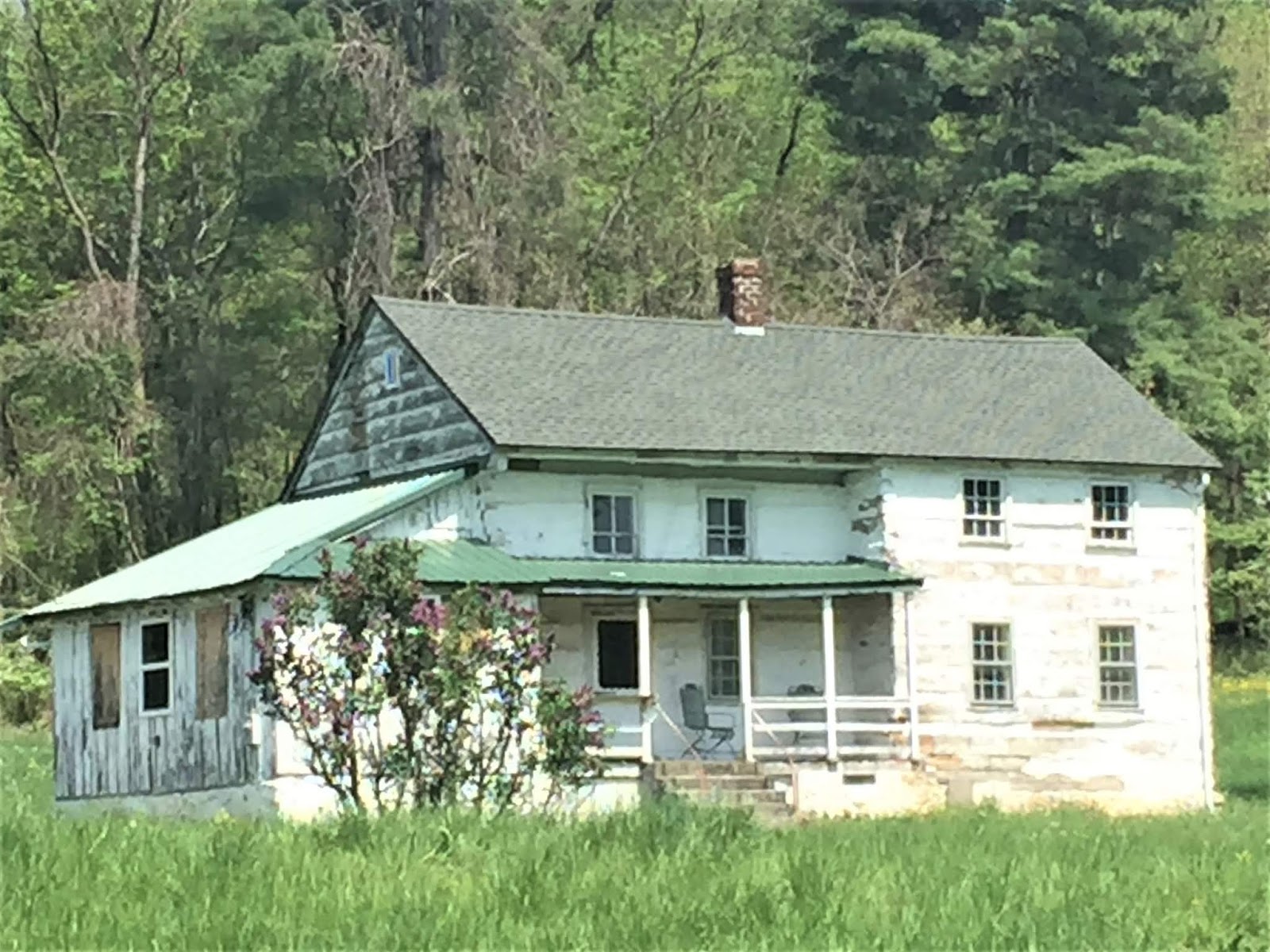 |
| Pumpkin Hall or Kroll Log House |
Hunger was calling, so I decided to head over to Blank’s Tavern (formerly Annette’s Bar and Grill).

 |
| Kaiser Refractories Plant |
After lunch, I wandered over to the Kaiser Refractories Plant – a clay brick plant. Built in 1902, the Big Savage Fire Brick Company built the plant to take advantage of the valuable clay reserves on the property. Oh! And there was definite evidence of what they used the clay for – bricks, bricks, and more bricks!!
Essentially, a fire brick, firebrick, or refractory brick is a block of refractory ceramic material used in lining furnaces, kilns, fireboxes, and fireplaces. A refractory brick is built primarily to withstand high temperature, but will also usually have a low thermal conductivity for greater energy efficiency.
Here is the timeline of the Refractories Plant:
This local fire clay was first discovered in Mount Savage, MD in 1839 and the Mount Savage Fire Brick Works began operation in 1841. This same company was incorporated as the Union Mining Company in 1864.
 |
| Lots and lots of bricks! |
I left the Plant and made my way over to Switch No. 9, which is an integral part of the railroad system running through western Maryland. The switchover from the Western Maryland Railway to the Cumberland and Pennsylvania Railroad still occurs at Switch No. 9 today. The train itself remains the same – only the name of the railroad changes at this point.
 |
| Merge of WM and C&P Railroads |
The Great Allegheny Passage Bike Trail runs along the side of the railroad – similar as how a towpath runs along the side of a canal. I found the railroad (and obviously the bike trail) but could not figure out how to access the area.
 |
| Great Allegheny Passage Trail |
Thankful my car and I arrived in one piece, I got out and started walking along the bike trail. As luck would have it, my parking spot was only ½ mile or so from Switch No. 9! I walked over to it and just stared. How cool!
 |
| Switch No. 9 |
So, there I am standing in the middle of an ACTIVE train track for several minutes staring at the switch and running through my head how it worked when someone on the bike trail yells, “Throw!” I looked up and both of us laughed. It was at this moment I decided that I probably should move off the track in the event a train were to appear. The individual (jokingly) yelled, “Throw!” because he was referring to what someone does to the Switch to have the train switch rails. Much as I would have liked to do this, I thought better. Lord only knows where that train would have ended up! Haha!
It was getting late, so I walked back to my car trying to figure out if I was going to successfully make it back up that steep bank. I’m not going to lie. I was a little nervous. And guess what? My little car made it (note to self……send performance review to car company!) Whew!
Today was a very educational day, but I was still able to relax and take in the quiet of what used to be a bustling mining town. Zihlman is a lesser-known town in Maryland and you probably never heard of it, but it certainly has a story worth telling.
 |
| Jennings Run - Maryland tributaries to Three Forks Run & Wills Creek (North Branch Potomac River) |